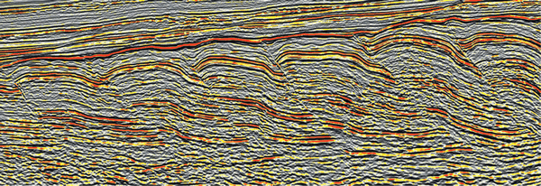
Figure 2.
High-quality seismic reflection data reveal thrust and fold structural geometry offshore Namibia. The context is provided on Fig. 3; these are the lowest structures on the slope (thrusts 1–6 on Fig. 5A). This image is ~17 km across and 2.5 s (seismic two-way-time) high, which equates to an approximate vertical exaggeration of 5:1 assuming a constant seismic velocity of 2.7 km/s. Image courtesy CGGVeritas and the Virtual Seismic Atlas.