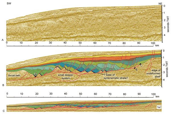
Figure 4.
A structural interpretation of the extensional domain, offshore Namibia, as located on Fig. 3. A. Clean line (courtesy of CGGVeritas and the Virtual Seismic Atlas). B. Interpreted section showing arbitrarily selected correlations across faults and wedges of growth strata (green and blue tones). The base of the growth strata is outlined by the thick blue pick; regional detachment and faults are in red. These sections have a vertical exaggeration of ~ 3.75:1, assuming a constant velocity of 2.7 km/s. C. The same structure with little inferred vertical exaggeration. The maximum extension implied by the separation along the detachment (distance from A–C) is 71 km, reducing to 44 km if the residual pre-kinematic strata is included. See text for further discussion.