GSA Today
Volume 20, Number 8 (August 2010)

About the cover:
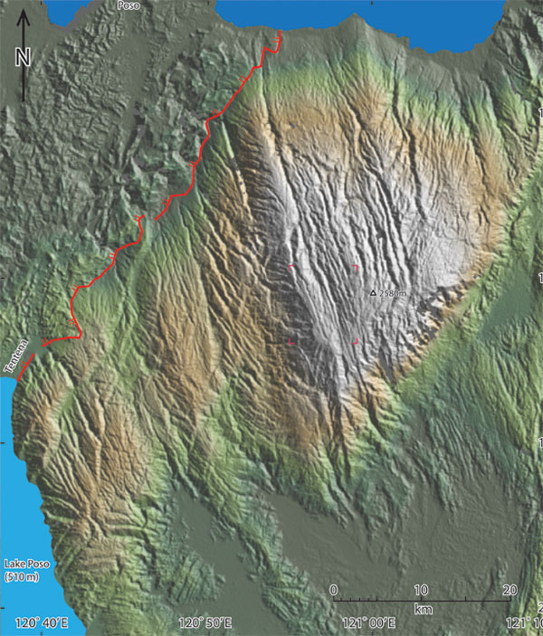
Shaded, false-color topography in part of central Sulawesi, Indonesia, derived from digital-elevation data from the 2000 Shuttle Radar Topography Mission. Red line across upper left indicates inferred, gently northwest-dipping extensional detachment fault. The striated Pompangeo crystalline complex that forms the massif in the center of the image is suspected to be a metamorphic core complex exhumed by tens of kilometers of displacement on the detachment fault. The unusual lineated topography is apparent at more detailed scale (e.g., aerial photo in Hamilton [1979, USGS Prof. Paper 1078, Fig. 86] of area indicated by magenta corners). See "Structural analysis of three extensional detachment faults with data from the 2000 Space-Shuttle Radar Topography Mission" by J.E. Spencer, p. 4–10.
© The Geological Society of America, Inc.