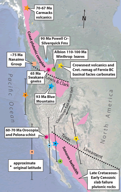
Figure 3.
Google Earth® map showing key paleomagnetic results for mid- to Upper Cretaceous rocks and separation of Late Cretaceous–Early Cenozoic Laramide slab failure rocks. Symbols without inner black dots are current locations, whereas those with dots are their paleomagnetically restored latitudes. Note that restoring the Lewis & Clark zone with the Texas Lineament is consistent with the paleomagnetic data and also reunites the Laramide magmatic belt. Leaf margin data from Miller et al. (2006); Nanaimo points from Kent and Irving (2010) and Kim and Kodama (2004); Carmacks from Enkin et al. (2006a); Silverquick–Powell Creek from Enkin et al. (2006b); Fernie, British Columbia (BC), from Enkin et al. (2000); Blue Mountains from Housen and Dorsey (2005).