GSA Today
Volume 25, Number 3 (March/April 2015)

About the cover:
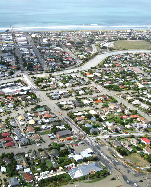
Aerial view of the suburbs of Bexley and New Brighton in eastern Christchurch, New Zealand, looking east to the Pacific Ocean on the day after the 22 February 2011 MW 6.2 Christchurch earthquake. Expulsion of sand and groundwater during earthquake-induced liquefaction and related surface subsidence of >30 cm caused flooding in this area and increased long-term flood hazard. Residential dwellings built in Bexley until 2005 (shown in foreground) are being demolished, and the land has been purchased and “Red Zoned” by the New Zealand central government. Photo by M.C. Quigley. See related article, p. 4–10.
© The Geological Society of America, Inc.