Figure 1.
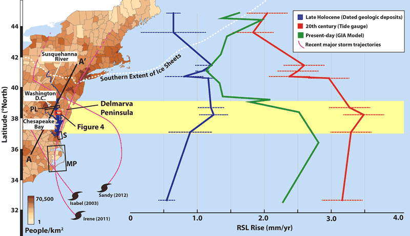
Map showing Atlantic coast of the United States with population density by county (U.S. Census Bureau, 2010) placed alongside Late Holocene and twentieth-century relative sea-level rise (RSL) rise curves (2 errors; Engelhart et al., 2009). RSL rise predicted from glacio-hydro-isostatic adjustment (GIA) modeling is from the M2 viscosity model (Peltier, 1996). Yellow shaded region brackets area of highest RSL rise on the Atlantic coast; dotted white line indicates maximum extent of the Laurentide ice sheet (LIS) (Dyke et al., 2002); magenta lines indicate tracks of major recent storms. PL, S, MP—Locations of coastal deposits dating to MIS 3 near central Chesapeake Bay (67–37 ka, n = 8; Pavich et al., 2006; Litwin et al., 2013), in southern Virginia (50–33 ka, n = 2; Scott et al., 2010), and North Carolina (59–28 ka, n = 15; Mallinson et al., 2008, Parham et al., 2013), respectively. A–A´ shows location of Figure 2A.