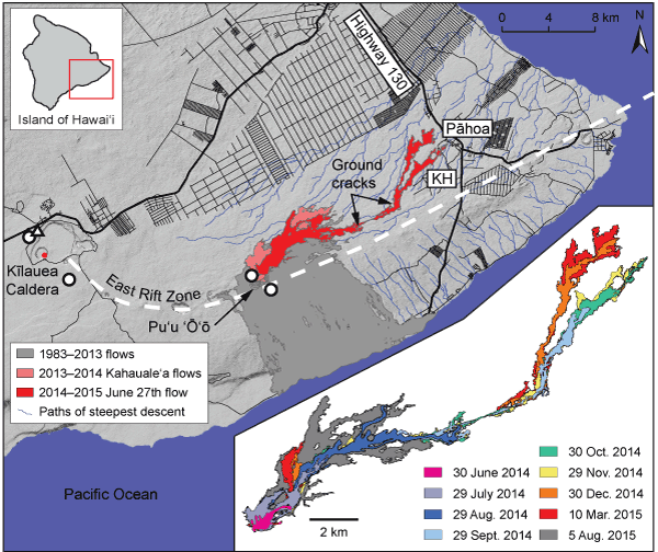
Figure 1.
Map of the eastern portion of Kīlauea Volcano, which comprises the Puna District of the Island of Hawai‘i. Red dot in caldera gives location of 2008–present eruptive vent. GPS stations indicated by white circles and tiltmeter by white triangle. East Rift Zone noted by white dashed line, with Pu‘u ‘Ō‘ō eruptive vent labeled and lava flows from 1983 to 2015 colored as gray—1983–2013; pink—2013–2014 Kahauale‘a lava flows; red—2014–2015 June 27th lava flow (as of 5 Aug. 2015). Pāhoa and Kaohe Homesteads (“KH”) are labeled, as is Highway 130 connecting Pāhoa and nearby communities to the rest of the island. Black lines are roads, with thicker lines indicating more heavily used roads. Denser groupings of roads occur in subdivisions. Blue lines are paths of steepest descent based on analysis of topography. Area of heavily cracked ground occurs between labeled arrows. Lower right gives zoom of the June 27th flow, with colors indicating flow extent over time.