Figure 4.
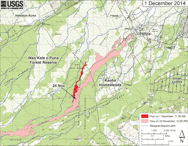
Map distributed to the public on 1 Dec. 2014, showing June 27th lava flow on 24 Nov. 2014 (pink), and expansion as of 1 Dec. 2014 (red). Blue lines are calculated paths of steepest descent. Black lines are roads.

Map distributed to the public on 1 Dec. 2014, showing June 27th lava flow on 24 Nov. 2014 (pink), and expansion as of 1 Dec. 2014 (red). Blue lines are calculated paths of steepest descent. Black lines are roads.