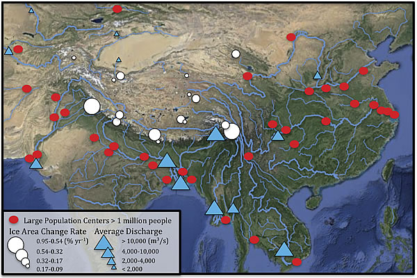
Figure 4.
Earth’s “Third Pole” (TP, also known as the Tibetan Plateau). Melted snow and ice from the TP generates major river systems including the Indus, Ganges, Salween, Mekong, Yangtze, and Huang He. Red dots—population centers with > 1,000,000 people that are served by these major river systems; white dots—areas of glacier loss as measured on 7,090 glaciers across the TP from the 1970s to 2000s (modified from Yao et al., 2012); blue triangles—average discharge of rivers. The base map and population centers are modified from Google Earth and the river drainages are modified from International Rivers database.