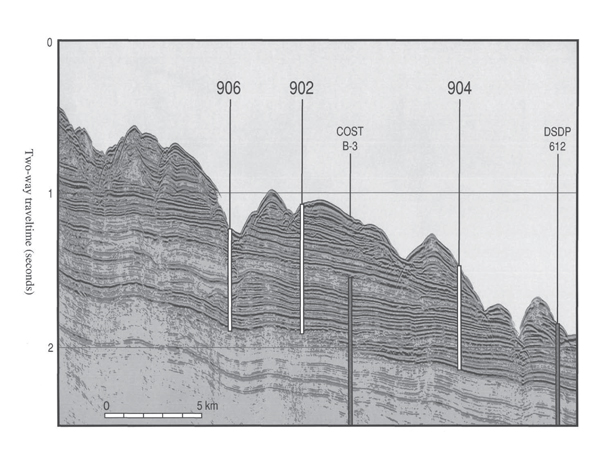
Figure 1.
Multichannel Seismic Line 1027 in Baltimore Canyon, used to locate the best sites (902, 904, and 906) during Ocean Drilling Program Leg 150 (Mountain et al., 1994). Cored intervals are shown in white. Also shown are the locations of Deep Sea Drilling Project Site 612 (Leg 95) and the Continental Offshore Stratigraphic Test (COST) B-3 well. The COST B3 well was used to establish first-order age and facies successions. These sediments were cored to establish a history of sea-level variations along the mid-Atlantic U.S. continental margin. Mission-specific drilling platform Expedition 313 continued the coring in modern water depths of 30–35 m and recovered nearshore and onshore sediments deposited during Neogene changes in global sea level.