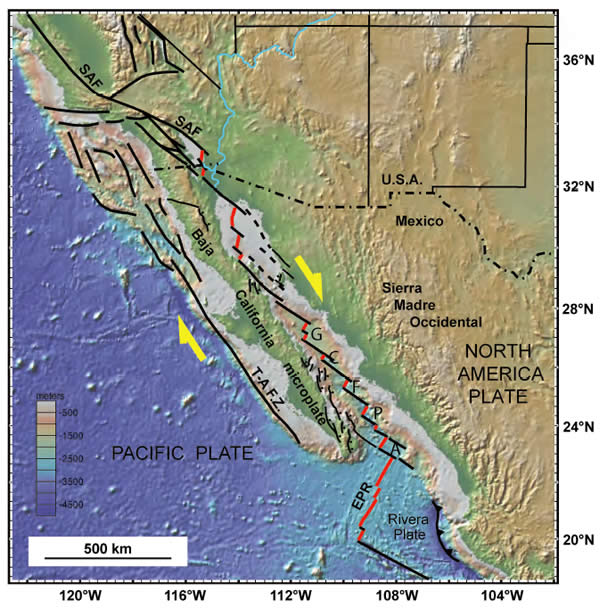
Figure 1.
Tectonic map of the Pacific–North America plate boundary of the Gulf of California–Salton trough region (modified from Dorsey and Umhoefer, 2011). Thin black lines are faults; red lines are spreading centers in the southern Gulf of California and complex pull-apart basins in the northern Gulf of California and Salton trough. Abbreviations from north to south: SAF—San Andreas fault; G—Guaymas spreading center; C—Carmen spreading center; F—Farallon spreading center; P—Pescadero spreading center; A—Alarcón spreading center; T-A F.Z.—Tosco-Abreajos fault zone; EPR—East Pacific Rise. Normal faults on the Baja California peninsula and islands are selected young and active faults.