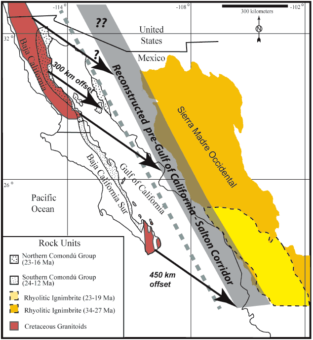
Figure 2.
A simple cartoon of the narrow corridor (gray) between the Baja California peninsula and the Sierra Madre Occidental middle Cenozoic volcanic belt that results if there was a total of ~450 km offset across the Gulf of California since 12–14 Ma (Gans, 1997; Sutherland, 2006; Fletcher et al., 2007; Lizarralde et al., 2007). Note that with that 450 km of offset the lower to middle Miocene volcanic arc of the Comondú Group, and the early oblique-divergent plate boundary, formed along the reconstructed gray corridor. The dashed gray line is the width of the Gulf of California–Salton trough corridor if the total offset was the more modest 300 km as indicated by the shorter arrow across the northern Gulf (Stock and Hodges, 1989; Oskin and Stock, 2003b). Smaller granite exposures in mainland Mexico, on the islands in the Gulf, and in the gap between the northern and southern Baja California granites are not shown.