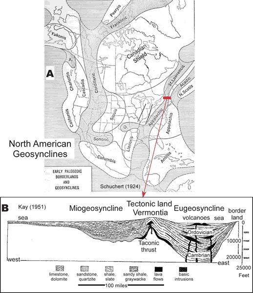
Figure 1.
Images of North American Paleozoic geosynclines. (A) Map of North American geosynclines from Schuchert (1924) with stippled areas showing geosynclinal troughs and the white areas as the borderlands (or old lands), which were considered to be the sediment source areas. (B) Cross section across the northern Appalachians after Kay (1951, redrafted by King, 1959) in region of red bar in A showing sediments in the miogeosyncline to the west, volcanic and sedimentary rocks in the eugeosyncline to the east, and the Vermontia tectonic land.