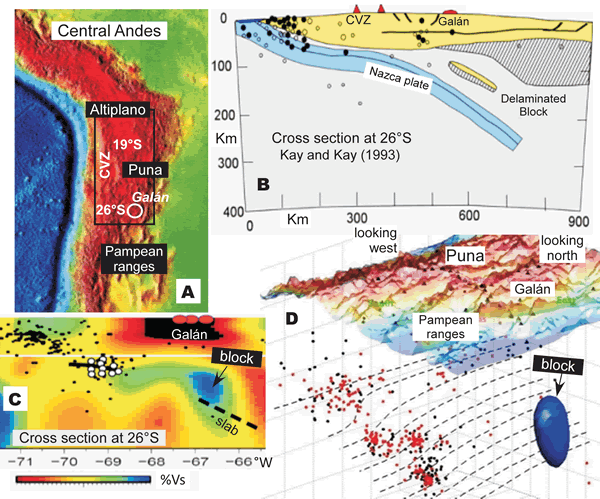
Figure 3.
Images for delamination of crust and mantle lithosphere. (A) Relief map showing the central Andean Puna–Altiplano plateau and central volcanic zone (CVZ) arc with the black box bounding areas where continental and crustal lithospheric delamination has been imaged. (B) Cartoon cross section at 26°S from Kay and Kay (1993) showing delaminated crustal (yellow) and lithospheric mantle (striped) under the backarc beneath the 6–2 Ma Cerro Galán ignimbrite caldera. (C) Surface wave tomographic image (in %Vs) based on Calixto et al. (2013) in an east-west transect at 26°S showing low velocity region (blue) interpreted as delaminated block above slab (dashed line). (D) Image modified from Calixto et al. (2013) showing delaminated block above the subducting slab under Cerro Galán. Dots are earthquake hypocenters; open and red circles are the best located.