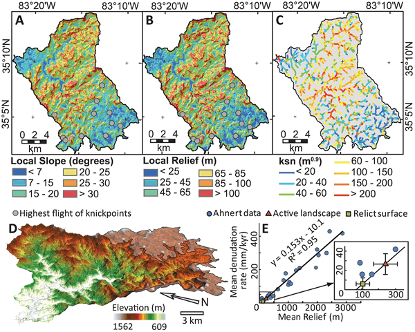
Figure 2.
Topographic and fluvial metrics and characterization of relict surface. (A and B) Maps of local (A) slope and (B) relief for the Cullasaja River basin. (C) Normalized channel steepness (ksn) averaged every 100 m along each stream reach. (D) Perspective view of the Cullasaja River basin highlighting the relict reach (shaded) preserved above the highest flight of knickpoints. (E) Plot showing Ahnert’s (1970) global relationship between mean relief and mean denudation and the estimated mean denudation rates of the active and relict portions of the Cullasaja River basin with 1s errors as determined in mean local relief calculations.